Trail Walking La Haute-Beaume - R50 Le Luzet - Photo

Les Hautes Alpes à découvrir ! GUIDE+

© OpenStreetMap contributors
Length
Length
8.4 km
Max alt
Max alt
1676 m
Uphill gradient
Uphill gradient
478 m
Km-Effort
Km-Effort  
14.8 km
Min alt
Min alt
1264 m
Downhill gradient
Downhill gradient
479 m
Boucle
Boucle
Yes
Creation date :
2018-03-23 05:40:55.035
Updated on :
2018-11-13 08:40:59.918

(0 Reviews)

Walking
Walking
3h00
Difficulty : Medium

Scan this QR Code to open this trail in the SityTrail application

FREE GPS app for hiking

Logo SityTrail SityTrail

IGN / Geographical institutes

Download SityTrail from the App Store Download SityTrail from Google Play

Logo SityTrail SityTrail World

The world is yours!

Download SityTrail from the App Store Download SityTrail from Google Play Download SityTrail on Huawei AppGallery

About

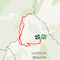
Trail Walking of 8.4 km to be discovered at Provence-Alpes-Côte d'Azur, Hautes-Alpes, La Haute-Beaume. This trail is proposed by Camping Les Rives du Lac.

Description

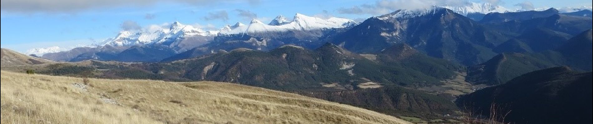
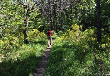
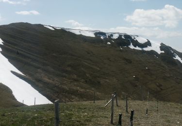
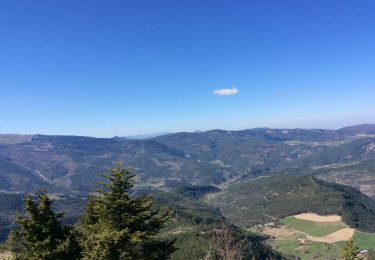
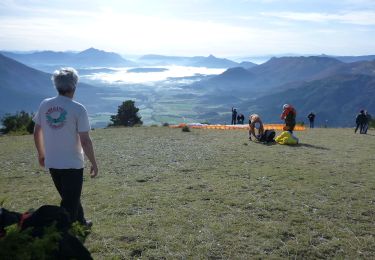
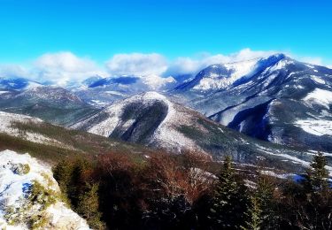
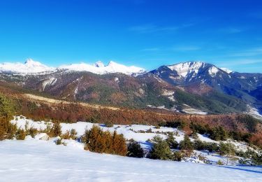
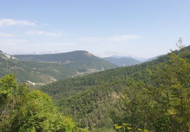
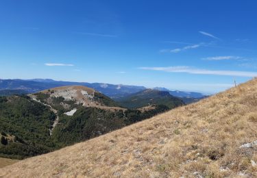
De magnifiques points de vues tout au long de cette randonnée. La montée s'effectue tout d'abord en forêt, de plus en plus clairsemée. En bout de piste, monter à gauche sur la crêt qu'il faudra suivre jusqu'au Luzet. Nous recommandons le retour par les crêtes qui ne sont pas dangereuses mais demandent d'avoir "le pied montagnard".

Elevation profile

Photos

Positioning

Country:
France
Region :
Provence-Alpes-Côte d'Azur
Department/Province :
Hautes-Alpes
Municipality :
La Haute-Beaume
Location:
Unknown
Start:(UTM)
708907 ; 4938662 (31T) N.

Trails nearby

Trail On foot Montbrand - 9587037(1) - Photo
On foot
GUIDE+

On foot

Easy
Montbrand, Provence-Alpes-Côte d'Azur, Hautes-Alpes, France
3.5 km | 4.6 km-effort
1h 2min
Yes
Trail Walking Val-Maravel - Le Luzet - Montagne Chauvet (Val-Maravel en Diois)... - Photo
Walking
Philindy26

Walking

Difficult
Val-Maravel, Auvergne-Rhône-Alpes, Drôme, France
11.4 km | 21 km-effort
4h 0min
Yes
Trail Walking La Beaume - Banne depuis le col de Cabre - Photo
Walking
pcugnod

Walking

Medium
La Beaume, Provence-Alpes-Côte d'Azur, Hautes-Alpes, France
10 km | 16.8 km-effort
3h 30min
Yes
Trail Walking La Haute-Beaume - R49  La Haute Beaume - Photo
Walking
GUIDE+

Walking

Easy
La Haute-Beaume, Provence-Alpes-Côte d'Azur, Hautes-Alpes, France
9.3 km | 14.8 km-effort
2h 30min
Yes
Trail Mountain bike Saint-Pierre-d'Argençon - HA J3 long - Photo
Mountain bike
thierryd

Mountain bike

Very easy
(4)
Saint-Pierre-d'Argençon, Provence-Alpes-Côte d'Azur, Hautes-Alpes, France
34 km | 42 km-effort
2h 45min
No
Trail Walking La Beaume - Ranc de Chamoussière - Crête de la Longeagne - Photo
Walking
PapouBertrand

Walking

Very difficult
La Beaume, Provence-Alpes-Côte d'Azur, Hautes-Alpes, France
12.9 km | 23 km-effort
5h 17min
Yes
Trail Walking Montbrand - Crête du Luzet départ de Creyers - Photo
Walking
PapouBertrand

Walking

Difficult
Montbrand, Provence-Alpes-Côte d'Azur, Hautes-Alpes, France
9.7 km | 18 km-effort
5h 8min
Yes
Trail Walking Beaurières - tour de Banne 1643m - Photo
Walking
tyax93

Walking

Easy
Beaurières, Auvergne-Rhône-Alpes, Drôme, France
10.7 km | 17.9 km-effort
3h 35min
Yes
Trail Walking Val-Maravel - le pilhon la blanche.mont chauvet  - Photo
Walking
Joel26400

Walking

Medium
Val-Maravel, Auvergne-Rhône-Alpes, Drôme, France
14.5 km | 27 km-effort
7h 6min
Yes


Close
My subscriptions